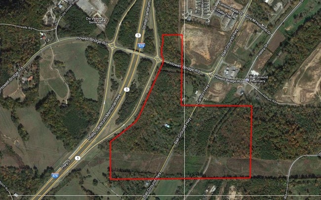
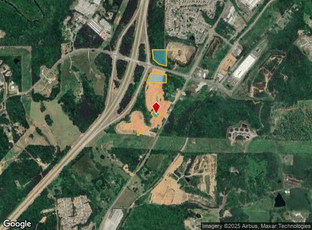
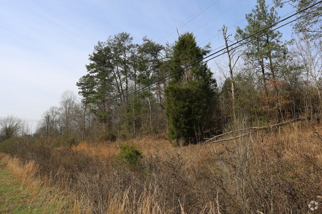
Property Record
7871 Howell Bridge Rd, Ball Ground, GA 30107
NEARBY LISTINGS FOR SALE OR LEASE
Property Detail
7871 Howell Bridge Rd
003N01-00000-083-000-0000
L 139 150 151 3RD D TR C, E, F, G
Agriculturalland
Cherokee
X
Georgia
13057C0159E
139
2025
4.35 AC
2025
Cherokee County
090101
Atlanta
2,358 SF
Atlanta-Sandy Springs-Roswell, GA
DEMOGRAPHICS near 7871 Howell Bridge Rd
1 Mile
3 Mile
5 Mile
2024 Total Population
1,351
5,573
17,237
2029 Population
1,564
6,398
19,707
Pop Growth 2024-2029
+ 15.77%
+ 14.80%
+ 14.33%
Average Age
40
41
41
2024 Total Households
482
1,999
6,130
HH Growth 2024-2029
+ 15.98%
+ 14.96%
+ 14.44%
Median Household Inc
$95,512
$91,701
$87,961
Avg Household Size
2.80
2.80
2.80
2024 Avg HH Vehicles
2.00
2.00
2.00
Median Home Value
$361,428
$348,508
$351,629
Median Year Built
1997
1998
2001
Nearby Places
- Restaurants
- Banks
- Shops
- Fitness
- Groceries
SALE & LEASE HISTORY
LISTING DATE
SALE/LEASE

Oct 29, 2018
For Sale
Nearby Properties
Address
Land Use
TOTAL SIZE
Lot Size
Zoning
Address
Land Use
TOTAL SIZE
Lot Size
Zoning
2,752 SF
959.77 AC
AG
Address
Land Use
TOTAL SIZE
Lot Size
Zoning
142,837 SF
15.16 AC
TND
Address
Land Use
TOTAL SIZE
Lot Size
Zoning
687,913 SF
24.31 AC
LI
Address
Land Use
TOTAL SIZE
Lot Size
Zoning
296,607 SF
46.53 AC
LI
Address
Land Use
TOTAL SIZE
Lot Size
Zoning
107,556 SF
13.77 AC
TND
Address
Land Use
TOTAL SIZE
Lot Size
Zoning
84,304 SF
18.65 AC
HI
Address
Land Use
TOTAL SIZE
Lot Size
Zoning
9,142 SF
89.03 AC
LI
Address
Land Use
TOTAL SIZE
Lot Size
Zoning
30,816 SF
63.71 AC
LI
Address
Land Use
TOTAL SIZE
Lot Size
Zoning
108,892 SF
16.53 AC
LI
Address
Land Use
TOTAL SIZE
Lot Size
Zoning
83.99 AC
LI
Address
Land Use
TOTAL SIZE
Lot Size
Zoning
123.28 AC
LI
Address
Land Use
TOTAL SIZE
Lot Size
Zoning
35,530 SF
15.18 AC
TND
Address
Land Use
TOTAL SIZE
Lot Size
Zoning
73,584 SF
10.93 AC
LI
Address
Land Use
TOTAL SIZE
Lot Size
Zoning
1 SF
54.80 AC
AG
Address
Land Use
TOTAL SIZE
Lot Size
Zoning
76,696 SF
5.75 AC
LI
Address
Land Use
TOTAL SIZE
Lot Size
Zoning
21,896 SF
1.63 AC
LI
Address
Land Use
TOTAL SIZE
Lot Size
Zoning
107,250 SF
4.40 AC
LI
Address
Land Use
TOTAL SIZE
Lot Size
Zoning
15,748 SF
35.85 AC
HI
Address
Land Use
TOTAL SIZE
Lot Size
Zoning
24,800 SF
100.45 AC
HI
Address
Land Use
TOTAL SIZE
Lot Size
Zoning
13,754 SF
2.31 AC
TND
Address
Land Use
TOTAL SIZE
Lot Size
Zoning
19.45 AC
LI
Address
Land Use
TOTAL SIZE
Lot Size
Zoning
51.33 AC
LI
Address
Land Use
TOTAL SIZE
Lot Size
Zoning
106,396 SF
12.42 AC
LI
Address
Land Use
TOTAL SIZE
Lot Size
Zoning
85,876 SF
3.96 AC
LI
Address
Land Use
TOTAL SIZE
Lot Size
Zoning
42,290 SF
15.42 AC
GC
Address
Land Use
TOTAL SIZE
Lot Size
Zoning
150,280 SF
0.18 AC
LI
Address
Land Use
TOTAL SIZE
Lot Size
Zoning
257,850 SF
4.32 AC
LI
Address
Land Use
TOTAL SIZE
Lot Size
Zoning
45,849 SF
4 AC
LI
Address
Land Use
TOTAL SIZE
Lot Size
Zoning
69.15 AC
LI
Address
Land Use
TOTAL SIZE
Lot Size
Zoning
43,340 SF
7.22 AC
LI
The World's #1 Commercial Real Estate Marketplace
Connect with us
© 2025 CoStar Group
The information above has been obtained from sources believed reliable. While we do not doubt its accuracy we have not verified it and make no guarantee, warranty or representation about it. It is your responsibility to independently confirm its accuracy and completeness. Any projections, opinions, assumptions, or estimates used are for example only and do not represent the current or future performance of the property. The value of this transaction to you depends on tax and other factors which should be evaluated by your tax, financial, and legal advisors. You and your advisors should conduct a careful, independent investigation of the property to determine to your satisfaction the suitability of the property for your needs.